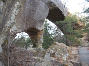
SUMMARY: An easy stroll out to an amazing view.
RATING: Easy loop Walk (about 0.8 miles) The end of the walk has the only difficult part with about 75 steps to climb. Restrooms are available at trailhead.
BEST TIME OF YEAR TO WALK: Early spring when flowers are blooming or autumn when you can catch the fall colors. The USDA Forest Office is located in Winchester, Kentucky about an hour from Red River Gorge. For up to date information either stop in the Ranger District Office, visit their website or telephone: (859) 745-3100
AMOUNT OF TIME NEEDED: Allow a half of an hour (less than 1 hour) to enjoy this walk.
DIRECTIONS TO TRAILHEAD:
- From rest area at exit #33 off of the Mountain State Parkway Turn left, and return to the Mountain State Park – West (8 miles)
- Take Exit 40 for for KY-15/KY-715 toward Beattyville. (0.3 miles)
- Turn right at KY-15 N/KY-715 N. (0.7 miles)
- Take the 1st right onto KY-715 N. (4.9 miles)
- Turn left on to Sky Bridge Recreation Area Road. (0.3 miles)
- Park in Sky Bridge parking area at the end of road.
- From the Sky Bridge Trailhead follow Trail #214 Sky Bridge Trail to Sky Bridge- you will be on top (0.2 miles)
- Continue following Trail #214 Sky Bridge Trail until you are below Sky Bridge (0.3 miles)
- Continue following Trail #214 Sky Bridge Trail until you arrive back at parking area (0.3 miles)


