
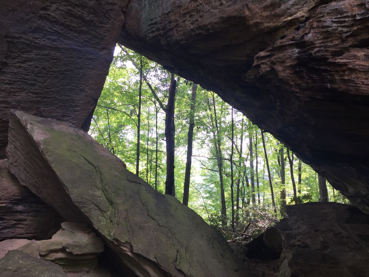
Eholia Arch
SUMMARY: A moderate hike to the seldom visited Eholia Arch and Anvil Arch. While Eholia Arch is a nice arch, Anvil Arch is one that you could easily skip. There are plenty of arches I recommend visiting before checking out this pair. This hike starts off of Tunnel Ridge Road, a little bit past the Gray’s Arch Picnic area, and there are plenty of descent campsites at the beginning of this hike.
RATING: Moderate day (out and back-not loop) hike (approximately 2.6 miles total;) This hike uses only unmarked trails and many people have trouble navigating the hike. This hike has scrambles/climbs that can be dangerous or deadly. A quality map, compass and deep woods navigating skills are essential for your safety on this hike.
BEST TIME OF YEAR TO HIKE: Early spring when flowers are blooming or autumn when you can catch the fall colors. The USDA Forest Office is located in Winchester, Kentucky about an hour from Red River Gorge. For up to date information either stop in the Ranger District Office, visit their website or telephone: (859) 745-3100.

Eholia Arch
AMOUNT OF TIME NEEDED: Allow a half of a day (2-4 hours) to enjoy this hike. Some can hike it faster, but most arrive at Eholia Arch and spend time exploring and resting. The scenery is spectacular, the geology is interesting; and Eholia arch is a perfect place to have lunch and explore. Pack a lunch and enjoy the adventure!
DIRECTIONS TO TRAILHEAD:
- From rest area at exit #33 off of the Mountain State Parkway Turn left, and go to end of road (.3 miles)
- Turn Right onto KY 15 (3.3 miles)
- Turn Left onto Tunnel Ridge Road (1.4 miles)
- Park at the Woodland Parking Area (on left)
DETAILS:
-

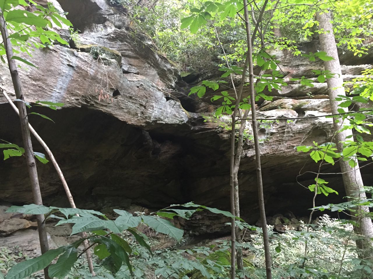
Anvil Arch
Follow an unmarked trail as it passes several campsites. Once you are past the campsites, the trail becomes very difficult to follow and/or non existent. Head around the top of the ridge to Waypoint #1, from where it is possible to descend below the ridge. Please note you cannot get to either arch from above, once you have descended below the ridge, you can access both arches. (0.7 miles)
- Descend to Waypoint #2, and continue following below the ridge line until you get to Eholia Arch. Eholia arch is in the ridge line, so if you stay just below (to the left) of the ridge line where it is somewhat passable, you will be able use the ridge line for orientation. As you make you way around you will pass through a nice rock shelter. (0.4 miles)
- Back track following the ridge line to Anvil Arch. You will pass the point (Waypoint #2) where you will descended from earlier. Once again following the ridge line is the best option. Anvil Arch will be high above you in the ridge line. (0.55 miles)
- Back track to Waypoints #2 and ascend to Waypoint #1. (0.25 miles)
- Return to the starting point, following the unmarked trails. (0.7 miles)
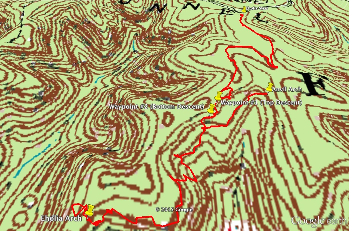 GPS Coordinates of start of hike at start of unmarked trail at Woodland Parking Area
37, 48’21.2 N
83, 40’40.0 W
GPS Coordinates of Waypoint #1 (Top of Descent)
37, 48’5.5 N
83, 40’45.8 W
GPS Coordinates of Waypoint #2 (Bottom of Descent)
37, 48’4.2 N
83, 40’46.6 W
GPS Coordinates of Eholia Arch
GPS Coordinates of start of hike at start of unmarked trail at Woodland Parking Area
37, 48’21.2 N
83, 40’40.0 W
GPS Coordinates of Waypoint #1 (Top of Descent)
37, 48’5.5 N
83, 40’45.8 W
GPS Coordinates of Waypoint #2 (Bottom of Descent)
37, 48’4.2 N
83, 40’46.6 W
GPS Coordinates of Eholia Arch37, 47’56.6 N 83, 40’55.3 W GPS Coordinates of Anvil Arch 37, 48’6.7 N 83, 40’40.7 W
