SUMMARY: A moderate hike to both Rock Bridge and Turtle Back Arch. Rock Bridge is a spectacular site, and the unmarked trail to Turtle Back Arch make it a less visited site. While part of the trail to and from Turtle Back Arch is unmarked, it does not require difficult hiking through thorns or bushes as in some other hikes.
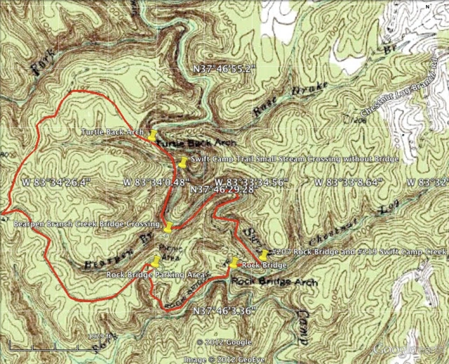
RATING: Moderate day (loop) hike (approximately 4.0 miles total;) This hike uses unmarked trails and many people have trouble navigating the hike. This hike has scrambles/climbs that can be dangerous or deadly. A quality map, compass, GPS and deep woods navigating skills are essential for your safety on this hike.
BEST TIME OF YEAR TO HIKE: Early spring when flowers are blooming or autumn when you can catch the fall colors. The USDA Forest Office is located in Winchester, Kentucky about an hour from Red River Gorge. For up to date information either stop in the Ranger District Office, visit their website or telephone: (859) 745-3100.

AMOUNT OF TIME NEEDED: Allow a half of a day (3-5 hours) to enjoy this hike. The scenery is spectacular, the geology is interesting; and, the 2 major arches are a perfect place to have lunch and explore. Pack a lunch and enjoy the adventure!
DIRECTIONS TO TRAILHEAD:
- From rest area at exit #33 off of the Mountain State Parkway Turn left, and return to the Mountain State Park – West (8.0 miles)
- Take Exit 40 for for KY-15/KY-715 toward Beattyville. (0.3 miles)
- Turn right at KY-15 N/KY-715 N. (0.7 miles)
- Take the 1st right onto KY-715 N/Sky Bridge Rd. (0.4 miles)
- Turn right on Rock Bridge Road. (3.1 miles)
- Go to the end of the road and park in the Rock Bridge Picnic Area.
DETAILS:
- From the Rock Bridge Picnic Area follow trail #207 Rock Bridge Trail from the first trailhead as you pull into the parking area. Follow trail to overlook for waterfall. (0.7 miles)
- Continue on trail #207 Rock Bridge Trail until you arrive at Rock Bridge. (0.1 miles)
- Continue on trail #207 Rock Bridge Trail until you arrive at Junction for trail #219 Swift Camp Creek Trail. (0.2 miles)
- Turn right onto trail #219 Swift Camp Creek Trail until you cross Bearpen Branch Creek on a bridge (the first bridge you arrive to.) (0.8 miles)
- Continue following the trail another 0.2 miles passing between 2 large boulders and come to the next stream crossing. (0.2 miles)
- Cross the stream and turn left on the second unmarked trail through some previously used campsites and up onto a ridge. (300 feet)
- Turn left on top of ridge and go over 2 rock faces, you will have to scramble up one of them. Continue on ridge trail until another rock face (go around left side of rock face to arch) which contains Turtle Back Arch. (200 feet)
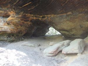
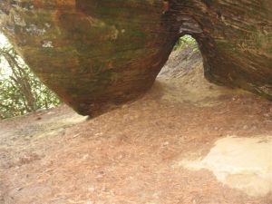
- Enjoy turtleback arch.
- Pass underneath Turtle Back Arch and turn right and follow trail up to the top of the arch. Cross over the arch and continue to walk along ridge in the same direction you were traveling when you arrived at the arch. The trail will require you to scramble up 1 more rock face before flattening out on top of the ridge. (0.5 miles)
- Continue until the trail ends at another unmarked trail. Turn left at the unmarked trail and continue following it. (0.5 miles)
- Turn left on Rock Bridge Road when the trail ends at Rock Bridge Road (0.9 miles)
- Arrive at the Rock Bridge Picnic Area

