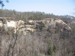
Indian Staircase from Across the Valley
Summary: This is one of my favorite hikes in the Red River Gorge area, but it must come with a warning. This hike can be VERY dangerous and possibly deadly. Everyone should know their ability and the ability of those who they are hiking with. Do NOT attempt this hike alone, and use extreme caution while climbing the Indian Staircase.
This hike while using well trod trails will leave “official” trails, and therefore it is essential hikers bring a quality topographical map, compass, and know how to use them in case of a problem. Finally I have published 2 different versions of this hike. The alternative version is slightly shorter, and you will see 1 different arch, but it is more difficult to navigate. Be Safe!
RATING: Difficult day hike(approximately 3.5 miles total;) very spectacular views; the scramble or climb up the Indian Stair Case is advanced, while it is very short (200 ft,) some people cannot complete it. This hike uses unmarked trails and some people have trouble navigating the hike.
BEST TIME OF YEAR TO HIKE: Early spring when flowers are blooming or autumn when you can catch the fall colors. The USDA Forest Office is located in Winchester, Kentucky about an hour from Red River Gorge. For up to date information either stop in the Ranger District Office, visit their website or telephone: (859) 745-3100
AMOUNT OF TIME NEEDED: Allow at least a half of a day (4-6 hours) to enjoy this hike. Some can hike it faster, but most arrive at the top of the Indian Staircase and spend time exploring and resting. The scenery is spectacular, the geology is interesting; and, the the top of the staircase is a perfect place to have lunch and explore.
DIRECTIONS TO TRAILHEAD:
- From rest area at exit #33 off of the Mountain State Parkway Turn left, and return to the Mountain State Park – East (8 miles)
- Take Exit 40 for for KY-15/KY-715 toward Beattyville. (0.3 miles)
- Turn right at KY-15 N/KY-715 N. (0.7 miles)
- Take the 1st right onto KY-715 N (9.7 miles)
- Park in Trail #220 Bison Way Trail Parking Area on right just after bridge after Gladie Historic Site.
DETAILS :
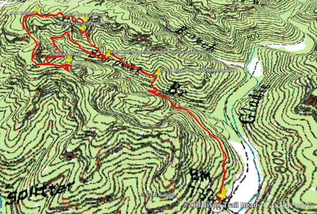
- From the Bison Way Trailhead follow Trail #210 Bison Way Trail to the termination of trail #210 Bison Way Trail at the Intersection with Trail #100 Sheltowee Trace Trail. (0.6 miles)
- Turn Left on Trail #100 Sheltowee Trace Trail (0.3 miles)
- Turn Right on an unmarked trail and ascend to the base of the Indian Staircase Spur Trail(0.25 miles.) This is the hardest part of the trail to locate and the reason many people never find the Indian Staircase. When you turn onto the Trail #100 Sheltowee Trace Trail begin counting creek or stream crossings. When you cross the 2nd little creek, the creek you are looking for is clearly defined as Trail #100 Sheltowee Trace Trail makes a sharp “U” as it crosses this creek, go another 100 feet. As the trail bends right you will see a well used unmarked trail leading up and off to the right. From this point until you return to Trail #100 Sheltowee Trace Trail you are unmarked trails, while well used there will be no signs. Follow this spur trail.
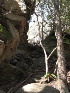
- Scramble up through cleft (water runoff-50 feet)
-
Scramble up to base of Indian Staircase (20 feet)
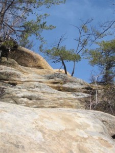
- Climb Indian Staircase (50 feet) USE EXTREME CAUTION- SOME MAY BRING A ROPE
- Scramble up to top of ridgeline. (50 feet)
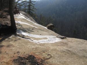
- Turn left on ridge line, and find a place for a break. (200 feet) A very popular spot is about 200 feet on the left side at an open overlook, there is a rock known as the “Frog’s Head” sticking out from the overlook. Do NOT attempt to climb out on the “Frog’s Head.” Find a good spot and enjoy a well deserved break.
- Continue on this trail (heading left or west) along the top of the ridge line. (0.7 miles) Stay close enough to the top of the ridge line to remain on well trod trails and be able to see the edge, but do NOT go to close to the edge for safety. After about 0.3 miles the ridge line and trail turn mostly south.
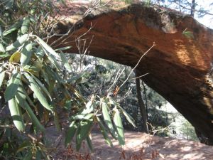
- Turn left on trail #100 Sheltowee Trace Trail (1.0 miles)- Pass Indian Arch after 100 yards, and KY 80 Arch at the end of the rock shelter below Indian Arch after another 100 yards. KY 80 Arch is unmarked and you will need to get off the trail and below the rock shelter to find it.
-
Turn right on trail #210 Bison Way Trail. (0.6 miles)
- Arrive at parking area
BONUS #1 : As you are traveling West on the Ridge Line at the top of the Indian Staircase (after 0.2 miles) you can drop down closer to the ridge line and find the largest rock shelter in the gorge (larger than a football field.) If you descend into the shelter continue through the shelter and back up (slightly to your right) to the “main” trail around the ridge.

Pingback: Midsummer Run & Hike « whataboutthesmiths