SUMMARY: A moderate hike to the seldom visited Andrew’s Double Arch and and one of my favorite (and popular) unmarked arches Star Gap Arch. There is a gravel road for the last 4 miles to the trailhead with basic services at the trailhead. Please note that the beginning and end of this hike is on gravel roads, which makes it easy walking, but not as exciting. The gravel road is closed to all vehicular traffic except for the forest service. If you want to see these arches and do not mind a little longer walk I highly recommend combining this hike with Double Arch and/or Auxier Ridge and Courthouse Rock, which makes it a much more exciting loop hike, and cuts out half of the gravel road. For info on those hikes check out Double Arch, Auxier Ridge, Courthouse Rock, Star Gap Arch, and Arch of Triumph or Double Arch, Star Gap Arch, and Arch of Triumph.
RATING: Moderate day (out and back-not loop) hike (approximately 3.2 miles total;) This hike uses unmarked trails and many people have trouble navigating the hike. This hike has scrambles/climbs that can be dangerous or deadly. A quality map, compass and deep woods navigating skills are essential for your safety on this hike.
BEST TIME OF YEAR TO HIKE: Early spring when flowers are blooming or autumn when you can catch the fall colors. The USDA Forest Office is located in Winchester, Kentucky about an hour from Red River Gorge. For up to date information either stop in the Ranger District Office, visit their website or telephone: (859) 745-3100.
AMOUNT OF TIME NEEDED: Allow a half of a day (2-4 hours) to enjoy this hike. Some can hike it faster, but most arrive at Star Gap Arch and Andrew’s Double Arch and spend time exploring and resting. The scenery is spectacular, the geology is interesting; and either arch is a perfect place to have lunch and explore. Pack a lunch and enjoy the adventure!
DIRECTIONS TO TRAILHEAD:
- From rest area at exit #33 off of the Mountain State Parkway Turn left, and go to end of road (.3 miles)
- Turn Right onto KY 15 (3.3 miles)
- Turn Left onto Tunnel Ridge Road (3.7 miles)
- Park at the End of Tunnel Ridge Road in the Auxier Ridge Parking Area
DETAILS:
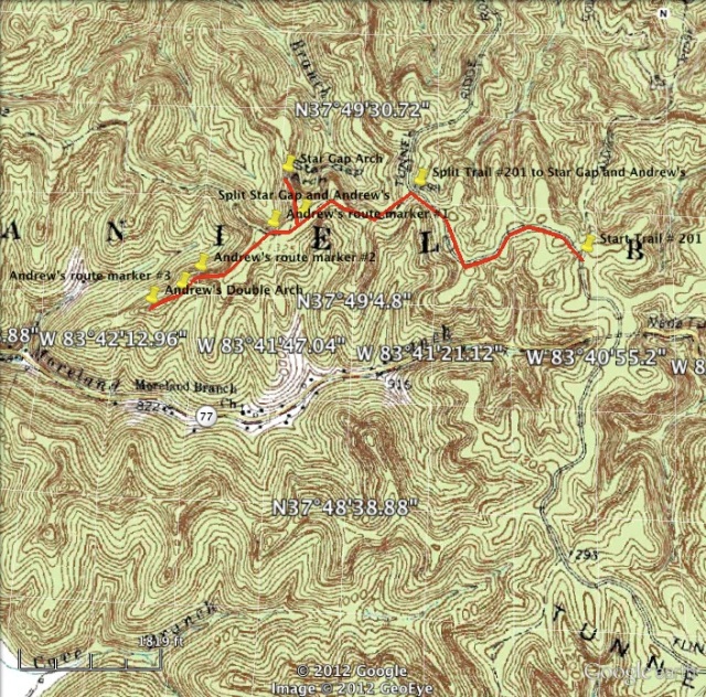
- Backtrack up Tunnel Ridge Road to a traffic circle with a gate across it and a sign that says Double Arch (100 yards.) The hike begins here.
- Turn Right (go around gate and past sign for Double Arch) and follow gravel road (0.65 miles.) As the road makes a bend to the right there is an unmarked trail leading off to the left with a sign #2071 at the intersection.
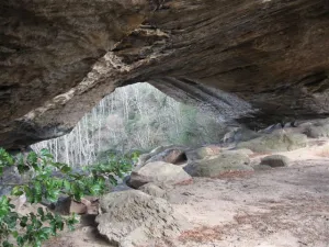
- Turn left and follow this unmarked trail to Star Gap Arch (0.5 miles.) The trail has a good deal of little spur trails leading to camp sites and other locations. Stay on the main trail and when in doubt stay right as you are following the trail around a ridge line, you will have passed the turn off leading out to Andrew’s Double Arch. The trail will eventually narrow and come on top of an exposed rock. You are on top of Star Gap Arch. To get below Star Gap Arch can be a little difficult and may require a rope. The easier ways to descend are back before you began crossing the arch on the left side (as you approached,) there are a couple of options.
- Return to the turn off leading to Andrew’s Double Arch. (0.15 miles)
- Turn right and follow the unmarked trail leading out to Andrew’s Arch. (0.5 miles) You will pass by the 3 route markers on your route. You will pass by some old cars and other garbage from a previous generation. After the garbage and route marker #1 it is easy to go on a spur onto another ridge a little too far to the south. If you make this mistake (we did) just back track and make your way to route markers #2 and #3.
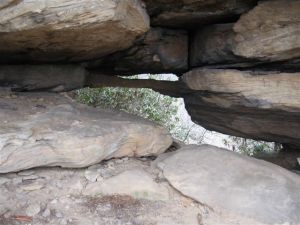
- When you arrive at route marker #3, make your way around the northern edge of the rock formation in front of you. You will be going around the right side until you arrive at Andrew’s Double Arch. (0.1 miles) This part of the route can be dangerous as you are on a cliff edge. Always use extreme caution.
- Back track to Trail #210 Double Arch Trail using the route markers. (0.75 miles)
- Turn right and return to the parking area on Trail #210 Double Arch Trail (0.65 miles)
 GPS Coordinates of start of hike at start of Trail #210 Double Arch Trail
37°49’11.30″N
83°40’57.30″W
GPS Coordinates of split of Trail #210 Double Arch Trail and unmarked trail to Star Gap Arch and Andrew’s Double Arch
37°49’19.50″N
83°41’24.50″W
GPS Coordinates of split of unmarked trails leading to Star Gap Arch and Andrew’s Double Arch
37°49’14.50″N
83°41’43.30″W
GPS Coordinates of Star Gap Arch
37°49’21.00″N
83°41’46.50″W
GPS Coordinates of Andrew’s Double Arch route marker #1
37°49’12.90″N
83°41’48.10″W
GPS Coordinates of Andrew’s Double Arch route marker #2
37°49’7.00″N
83°41’59.60″W
GPS Coordinates of Andrew’s Double Arch route marker #3
37°49’4.60″N
83°42’2.50″W
GPS Coordinates of Andrew’s Double Arch
37°49’2.50″N
83°42’7.20″W


